
ePRISMS SUPPORT PROJECT #2

PROJECT DESCRIPTION:
Conduct a Facility Utilization Survey, and Proactive Real Property:
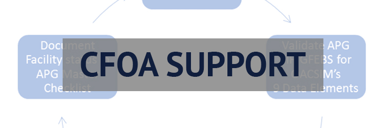
Interactive Space Management System (PRISMS) survey at APG, Maryland and provide the dgn with PRISMS polygons and PRISMS metadata. The contract also included support to upload all PRISMS Standard Files to the O&M Team for inclusion to ePRISMS. Furthermore this contract included providing support to edit/update GFEBS with RPI usage data generated from the FUS. There are 200 buildings VANJOH surveyed which comes to approximately 2 million square feet. In addition to using the PRISMS QAP 3.2.2, the following standards were used for surveying:
- Photos: Photograph every building surveyed with a front shot and an oblique shot that shows two sides of the building.
- Building Exteriors: VANJOH verified and updated the exterior dimensions of all buildings included in the survey. Laser measuring devices used had an accuracy of 0.25 inches.
- Building Interiors: When a building had exising CADD, VANJOH verified and updated floor layouts, structural columns, walls, permanent or semi-permanent partitions, locations of doors and windows, its category code, unit identification code (UIC) and unit description. When the CADD did not exist for the building, VANJOH created the floorplan as they measured the interior and exterior of the building.
- Verify Room Numbers: A/E shall verify and update all room numbers within a building against existing drawings.
- Verify Areas: interior measurements were conducted with a laser measuring device that had an accuracy of 25 inches.
- All facilities with an area unit of measure will be made polygons. MicrostationV8i design file master units are English, working to be defined by DPW.
- ePRISMS: All new ePRISMS PSF floor plans were uploaded to the IMCOM O&M Team for loading into ePRISMS. All new Usage and Man Power data loaded into ePRISMS through the ePRISMS dashboard. All existing ePRISMS CADD data polygons were updated using the lastest ePRISMS Tools, then uploaded to ePRISMS using the ePRISMS Dashboard.
- DD1354 Forms: All Category Code converstions and updates were completed using the latested DD1354 Form for the appropriate approvals by the RPAO and HQ’s.
- Assignment Letters: Assignment letters were prepared, routed, approved and mailed to the necessary organizations for all UIC changes.
- GFEBS: All necessary updates were made in GFEBS using RPI Usage data. All pooled space, rental space, utilization rate and survey dates were updates.
Project Outcomes and Benefits: The following describes actions completed:
- Creation of 196 Facility CADD Floor Plans
- Survey of 1.8 Million GSF of facilities (196 Facilities) for Real Property Space Data.
- Entered 108 Facilities into the PRISMS with Real Property Data.
- Prepared Facility Utilization Reports on 196 Facilities (1.8 Million GSF).
- Updated Real Property Data into GFEBS system on 196 Facilities (1.8 Million GSF).
- Populated the PRISMS system with photos for 108 facilities.
- The ability to accurately update the real property inventory (GFEBS/PRISMS).
- Efficient determination of the locations of any/all organizations at APG.
- The determining the real net useable to gross ratios for space utilization calculations.
- Population comparison with the Army Stationing & Installation Plan (ASIP).
- The determining of true facility requirements through RPLANS justifying future projects.
Maximized SRM funding through accurate facility information.


DUNS#: 053214420
Cage Code: 1KBP5
Contract #: GS-35F-620GA

Aberdeen Proving Ground, MD
667.231.4588
info@vanjohgraphics.com

